Business Name:Skyline Surveyors
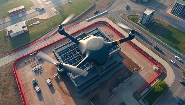
Description:Specializing in drone-based aerial surveys for architectural projects, construction sites, and urban planning initiatives. Utilizing drones equipped with high-resolution cameras and LiDAR technology to capture detailed site data and generate accurate 3D models.
Profitability:Drone surveys offer a cost-effective and efficient alternative to traditional land surveys, attracting architects, developers, and government agencies seeking accurate spatial data. The scalability and versatility of drone technology present opportunities for large-scale projects globally.
Required Skills:Familiarity with drone piloting regulations and safety protocols Proficiency in photogrammetry and LiDAR data processing Knowledge of architectural site analysis and surveying techniques Business development skills to secure contracts with architectural firms and construction companies
Go-To-Market (GTM) Strategy:Partner with architectural firms to offer drone surveying services as part of project packages. Showcase the benefits of drone surveys through case studies and testimonials on a dedicated website. Attend industry trade shows and conferences to demonstrate drone capabilities to potential clients. Collaborate with environmental agencies for eco-friendly architectural site assessments using drones.